Mount Fuji Hike
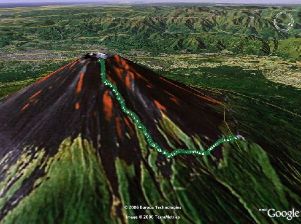
[Trail up to the summit of Mount Fuji as recorded by the Magellan eXplorist 600 GPS receiver I was carrying.
Superimposed on imagery from Google Earth.]
[Trail up to the summit of Mount Fuji as recorded by the Magellan eXplorist 600 GPS receiver I was carrying.
Superimposed on imagery from Google Earth.]
| The official hiking season for Mount Fuji is a short two months in summer: July 1st to August 31st. The rainy season and typhoon season can also cut into this time. You have to be flexible, watch the weather radar and pick a good, clear day to go. |
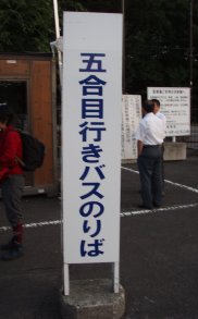
There are five hiking routes to the summit of Mount Fuji. This is a
description of a hike using the most popular route, the
Kawaguchikoguchi (河口湖口) Route.
The GPS trail of the ascending route is shown in green above. You're looking at 2305m (7562ft) to about 3700m (12,140ft) and back. Allow approximately 7 hours for hiking. I would rate it as a fairly easy day hike. This description is divided into stages according to stations. |
Note: Panoramic images can be clicked on for a larger view.
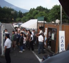
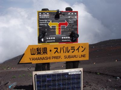
| The Fuji Subaru Line (富士スブルライン) is a paved toll road from the 1st station to the 5th station that ascends from 1400m to 2305m. The 5th station at the top of the road, known as the Kawaguchikoguchi 5th station (河口湖口五合目), is the start of the hiking trail. |
In the peak climbing season, the road is closed to private
vehicles. Only buses, taxis and bicycles (yay! for 200 yen) are allowed.
I had planned to have the experience of riding the Fuji Subaru Line by bike, but unfortunately my rear tire casing exploded in the parking lot and I didn't have a spare available. So I have only had the opportunity of riding the bus up the road. |
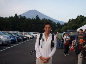
Waiting for the first bus (5;30am). Mt Fuji is in the background.
|
Gear geek details in the photo:
Leki aluminum ultralight trekking poles. Camelbak pack. 3 liters of a water/Gatorade mix, which sufficed for the entire hike. Drink tube can be seen on my right shoulder. Magellan eXplorist 600 GPS receiver dangling on my left shoulder.
Not visible (stuffed into Camelbak pack):
|
|
On the left is the bus stop sign.
Right picture was taken from inside the bus.
|
||
|
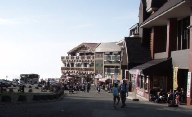
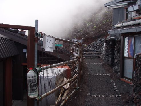
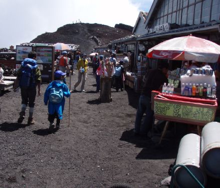
The 5th station.
Souvenir shops and restaurants. Toilets (price ranging from 50 yen to 100 yen). |
||
|
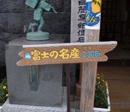
It's 2305m (7560ft) above mean sea level at the 5th station. |
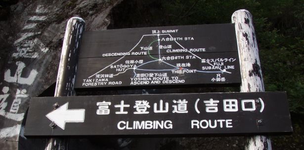
Note that the descending route takes a different path from the climbing route. It also has a different name, a source of potential confusion to those needing to make the correct choices when descending.
|
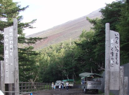
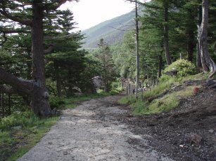
The trail entrance at the 5th station.
Note the black lava dirt road.
|
|
|
|
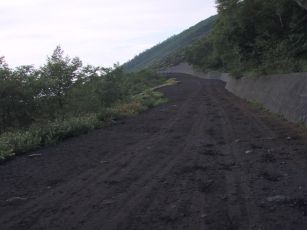
Trail changes to paving rocks and back again to black lava.
|
|
|
|
|
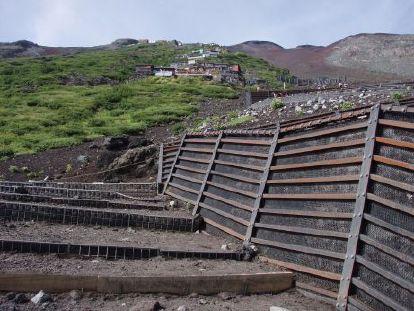
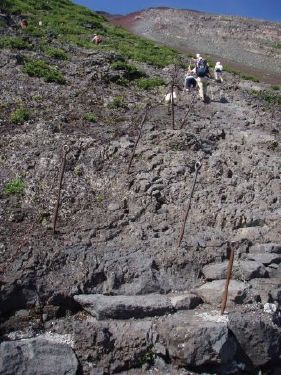
The mark of construction:
switchbacks and barriers against trail erosion and landslides.
Or it could be straight up a steep section of lava rocks.
|
|
|
|
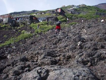
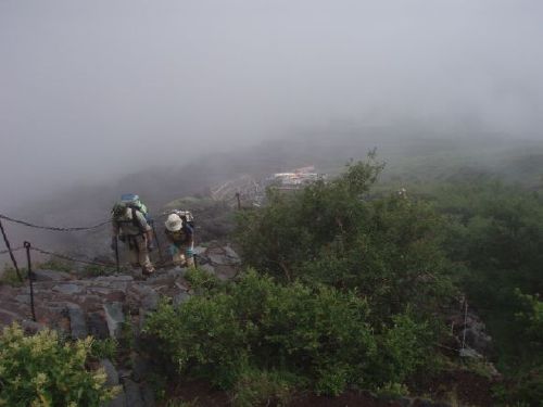
Looking back down towards the 7th station:
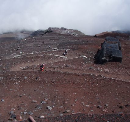
Up through lava but vegetation is still present at this level. Through the mist (clouds) to 3000m (9843 ft).
|
|
|
|
|
|
No Step!
|
|
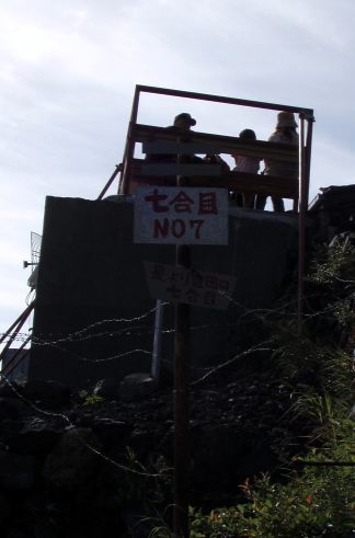
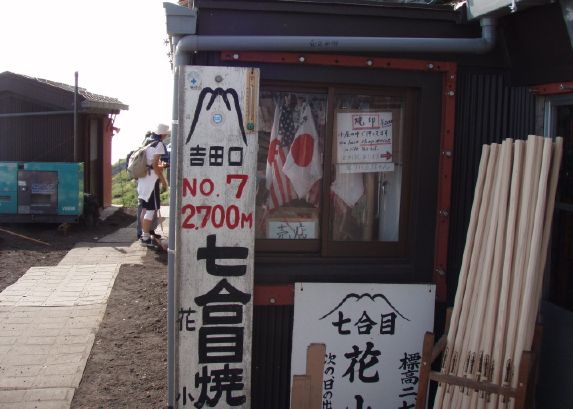
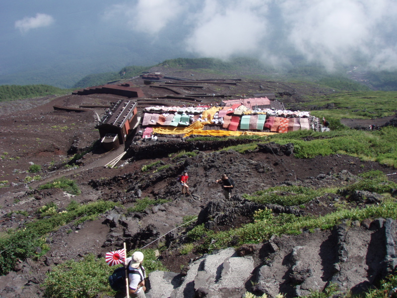
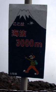
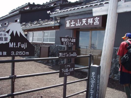
More stations come thick and fast. Here is one at 3250m (10663 ft). Hiking route is completely barren. We're on Mars! :-)
|
|
Great color at maybe 11,000 ft! (Bit windy as well.)
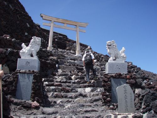
Entrance to the top: tori and commemorative white stone lions.
Someone thinks going up 33 times is worth commemorating.1
1[These is a saying in Japan that one who climbs Mt. Fuji once is a wise man and one who climbs Mt. Fuji more than once is a fool...]
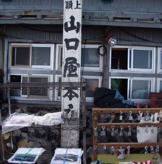
Also at the top: a veritable metropolis, ubiqituous vending machines! Further on there is a post office.
|
|
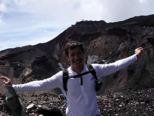
For the record: yo man, the crater! Around 3700m (12,140 ft). From 2305m (7560ft). A surprisingly easy hike.
|
Made it up with one Camelbak.
Actually, I had enough water to get down too. |
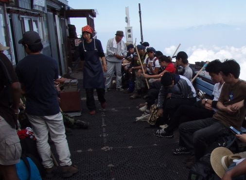
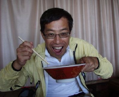
Reward time: a bowl of ramen right here at the highest restaurant in Japan!
|
|
The downclimb? Yawn...
|
Okay man, just one picture.
It's easy except you have make sure you take the right path down...2
2[There is at least one amusing gaijin blog out there,
|
|
[Sorry, big versions not yet available here. You can't click on them yet.]
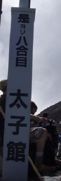
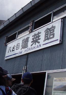
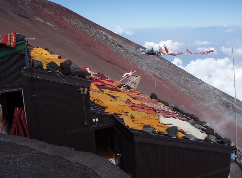
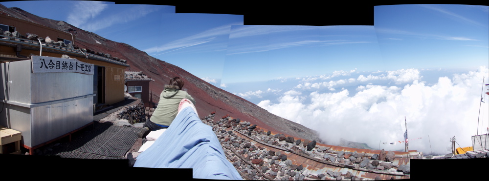
8th station Tomoekan (トモエ官). [8 pictures stitched, portrait style.]
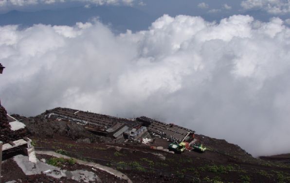
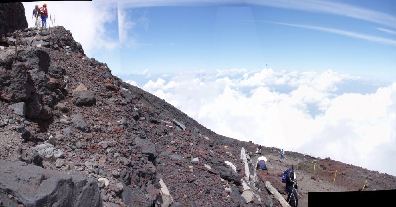
Even higher up. Rocks. Just rocks. [4 pictures stitched, portrait style.]
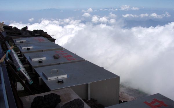
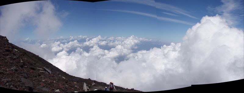
The cloud layer. [3 pictures stitched, portrait style.]
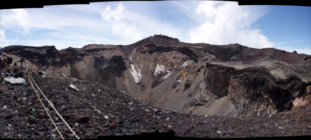
The crater at around 12,000 ft up.
Mt Fuji is considered to be an active but dormant volcano.
[6 pictures stitched, portrait style.]
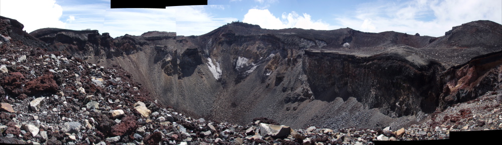
A second (and slightly wider) pano of the crater. [9 pictures stitched, portrait style.]
Hope you enjoyed the pictures. Go climb Fuiji (once)!
Sandiway Fong
August 2006