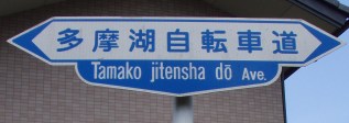
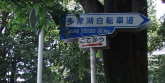
Tamako Cycling Road: Western Tokyo
| コンクリート・ロード | Concrete roads |
| どこまでも | All the way |
| 森をきり | Cutting forests |
| 谷を埋め | Filling valleys |
| West Tokyo | Western Tokyo |
| Mount Tama | Mount Tama |
| ふるさとは | My home town |
| コンクリート・ロード | Is a concrete road |
[You may need to set your brower to display Japanese Shift-JIS text encoding to see both the English and Japanese above.]
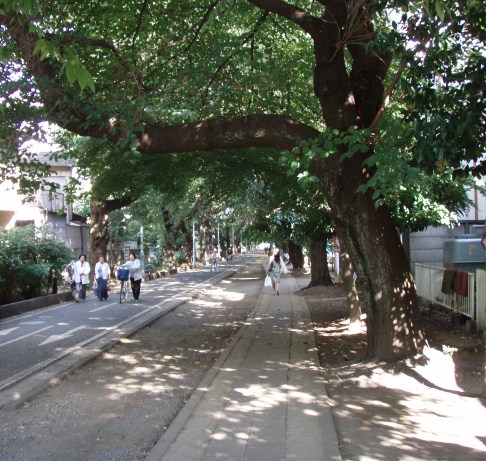
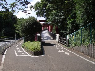
This was the tune from the Studio Ghibli movie set in Western Tokyo that was going through my head as I was riding on the Tamako Bicycle Road.1,2 It's amazing that in the seemingly endless and densely packed maze of an urban concrete jungle that is Greater Tokyo, one can find a bike path that shoots as straight as an arrow from a small, easy-to-miss opening at the intersection of routes 7 and 12 all the way out to the beautiful, wooded Tama Lake. The relative serenity of the bike path is hightened by contrast to the nightmarish web of super-congested "concrete" roads needed to get to its start from the University of Tokyo (Komaba campus) near Shibuya. If I understand correctly, the straight-as-an-arrow bike path follows alongside a (buried) water pipe that transports water from the Tama Lake reservoir into central Tokyo.
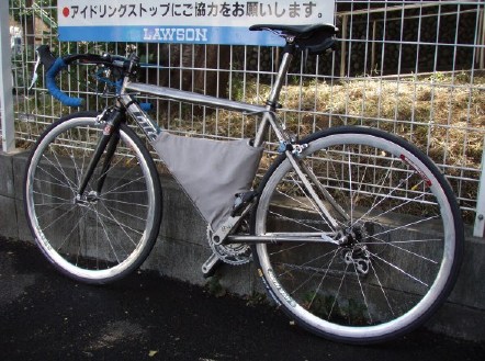
Re-assembled from the contents of a wheeled duffel bag for travel to Japan (cranks, stem, bars, seatpost, fork were removed to make it fit in a bag satisfying the requirements for checked baggage).
 |
 |
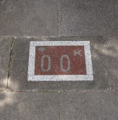
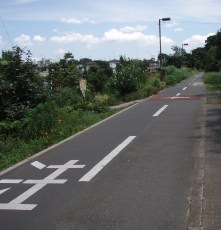
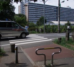
| Kilometer zero marker. | Red arrow points to the start. |
Yes, that decimal point and zero are significant. There is a marker every 1/10th of a kilometer.
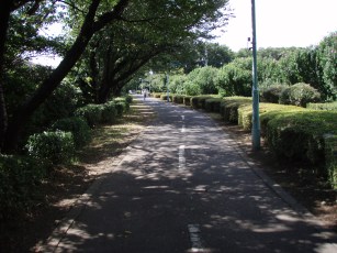
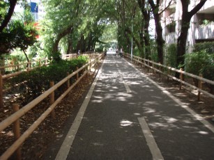
For much of its length, the bike and pedestrian paths are separate. However, as you can see, it makes no difference...
 |
 |
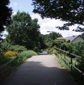
| Trees leaning into the path. | Near the Lake Tama section. |
 |
 |
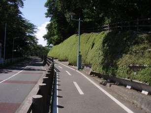
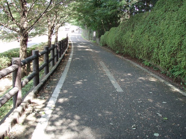
| Near the start. | A plain section. |
 |
 |
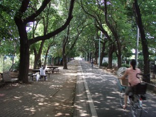
| Seating off to one side. | Tree-lined, well-shaded. |
Hopefully the pictures above will give you some idea of the varied sections of the bike road.
Just plain beautiful here. Simply can't help wondering what it's like in the Fall instead of hot and early August with the bike computer registering 41C (106F) in sunlight.
 |
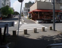 |
| Road crossing. | Bike road disappears. |
Near Kodaira station (picture above on the right), the bike road seems to disappear altogether. However, since it's straight as an arrow, you can just follow your instincts, and sure enough it re-appears at the other end of the square.
 |
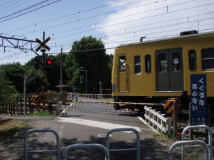 |
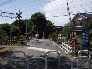
| One barrier down. | Two barriers down. |
I stopped when the red light seen on the left starting flashing and the first barrier came down blocking half the bike path at the railroad crossing. This old guy continued pedalling and jinked around the barrier. Seconds later, the second barrier came down and a yellow Seibu-Shinjuku line train roared past.
 |
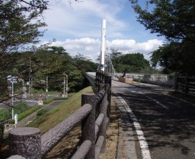 |
| Red truss bridge. | White suspension bridge. |
Simply gorgeous, especially considering it's the Western Tokyo area. We have actually looped back around the lake to the town of Higashi Murayama, near the setting for the My Neighbor Totoro Studio Ghibli movie. The town is just like any other in the area, fully concretized, but one can see vestiges of the woods where Totoro might have lived.
 |
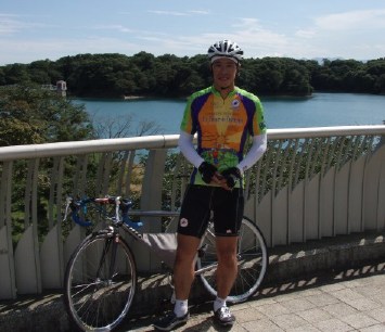 |
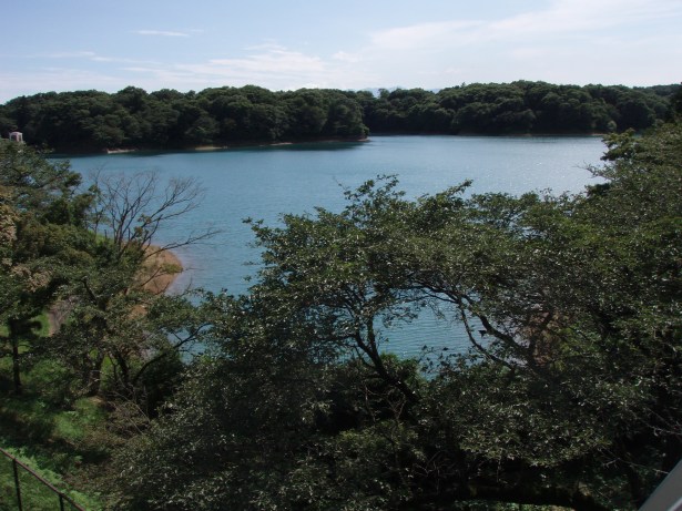
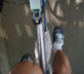
| A blur of pedalling. | Me at Lake Tama. |
For safety, and given the numerous crossings, I found that riding speed on the bike path to be practically restricted to about a 20km/hr average. Only on the Lake Tamako portion of the bike path, do you actually have long stretches without interruption. For comparison, on roads leading to and from the bike path, my typical cruising speed when moving along with traffic is around 35-40km/hr.
It was a little difficult to take the picture on the left, given that I was looking down and trying to bike at the same time. (I selected a fairly quiet section of the road to try this.) I wanted to capture the motion blur (giving a sense of speed) plus the shadow cast by the bike.
 |
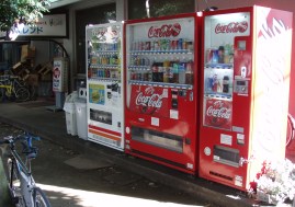 |
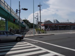
| A convenience store on the other side of the street. | Vending machines by the bike path. |
There are various places to stop, even a coffee shop or two. I had my Camelbak mounted on my bike, so I didn't need to stop, but there are plenty of opportunities to buy drinks etc. in 41C (106F) heat. There are even signs for bathrooms at perhaps two places that I remember.

This is a shot of one of the maps posted on boards on the route. It's about 22km for the entire road shown in red. At the endpoint by the dam, instead of retracing my steps, I took a regular road to cut across the end of the lake to rejoin the bike path at around kilometer 10.
Sandiway Fong
Tokyo, Japan
August 2006